 Catalogue PIGMA
Celtic Seas
Type of resources
Available actions
Topics
Keywords
Contact for the resource
Provided by
Years
Formats
Representation types
Update frequencies
status
Scale
Resolution
-
-

Ireland’s Marine Atlas is developed and maintained by the Marine Institute with funding by the Government of Ireland. This work is part supported by the Irish Government and the European Maritime & Fisheries Fund as part of the EMFF Operational Programme for 2014-2020. The atlas provides a one-stop-shop to view and download marine environmental data relevant to reporting under Ireland’s Marine Strategy Framework Directive (MSFD). The aim of the European Union’s MSFD directive is to protect more effectively the marine environment across Europe through the establishment of “good marine waters”. Data in Ireland’s Marine Atlas has been guided by the European Directive on harmonising environmental data across Europe within a spatial data infrastructure known as INSPIRE. INSPIRE Data Specifications (Data Models) have been used to manage data to the categories visible under THEMES in the atlas. Many of the layers displayed in the Atlas are also used in the National Marine Planning Framework (NMPF). This framework aims to bring together all marine-based human activities, outlining the government’s vision, objectives and marine planning policies for each marine activity. The NMPF report details how these marine activities will interact with each other in an ocean space that is under increasing spatial pressure, ensuring the sustainable use of our marine resources to 2040. Please read the following information carefully as it sets out the terms and conditions that govern the use of products and services on this website. Once you have read these terms and conditions click the "Agree" button at the bottom of the page to proceed. By clicking the "Agree" button you will be deemed to have accepted the terms and conditions, our legal notices and privacy statement.
-
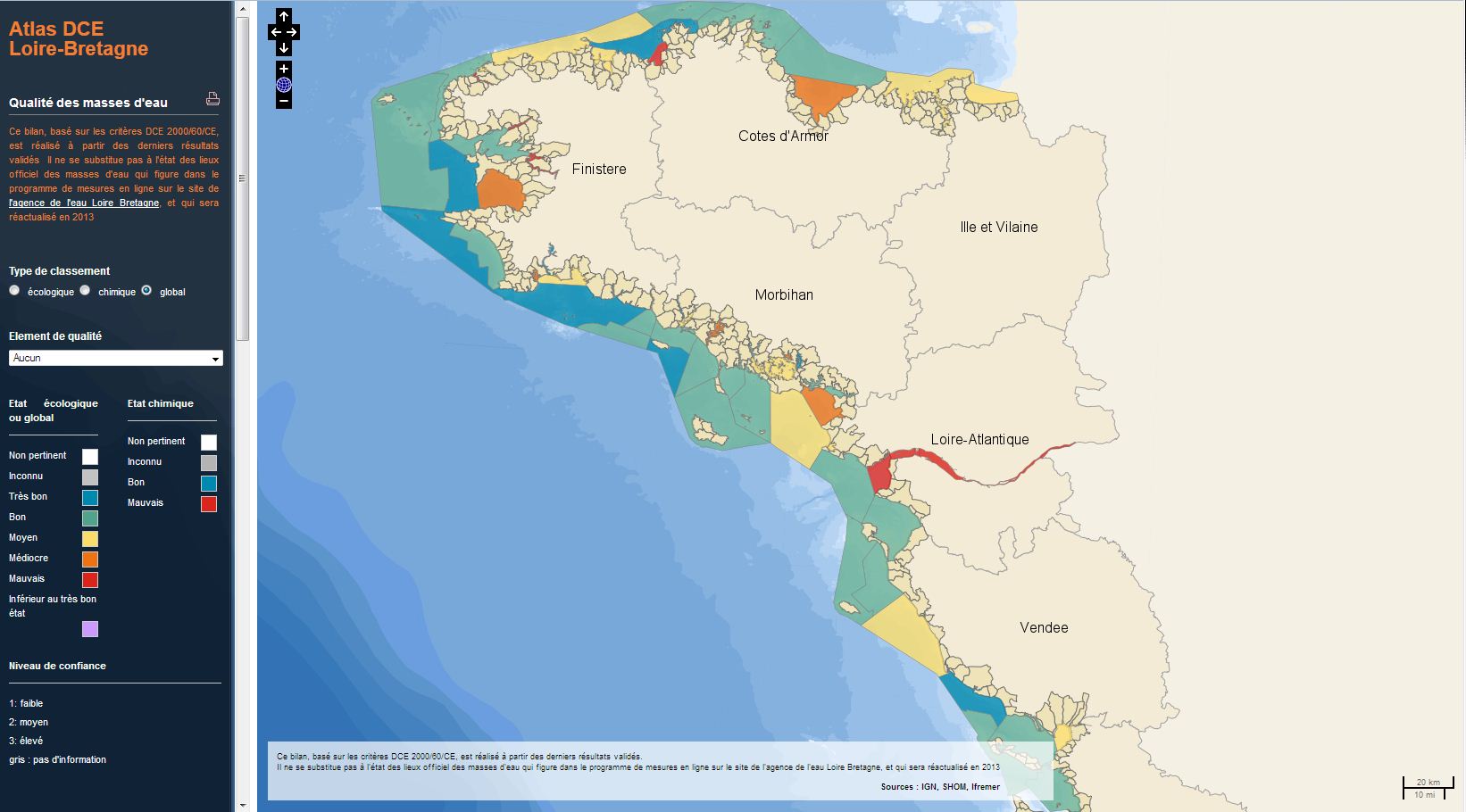
The analysis concerns the assessment of the overall state of the coastal and transitional waters of the Western Channel and the Bay of Biscay. It results from the combination of the ecological status and the chemical status of each water body according to the rules of the European Water Framework Directive (WFD). The most recent assessment of the state is presented in the DCE Loire-Bretagne atlas. Earlier reports are available in annual archives.
-
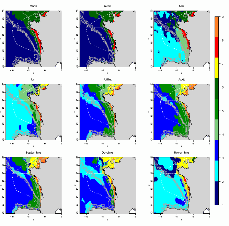
The statistical analysis used (Principal Component Analysis followed by a classification method) to identify groups common to all months and describe the evolution of these groups during the year. The data used allows for monthly tables showing the selected parameters, calculated over the entire geographic area with a resolution of 0.1 °. This method identifies 10 hydrological landscapes present at various times of the year, and characterized by homogeneous hydrological conditions.
-
-
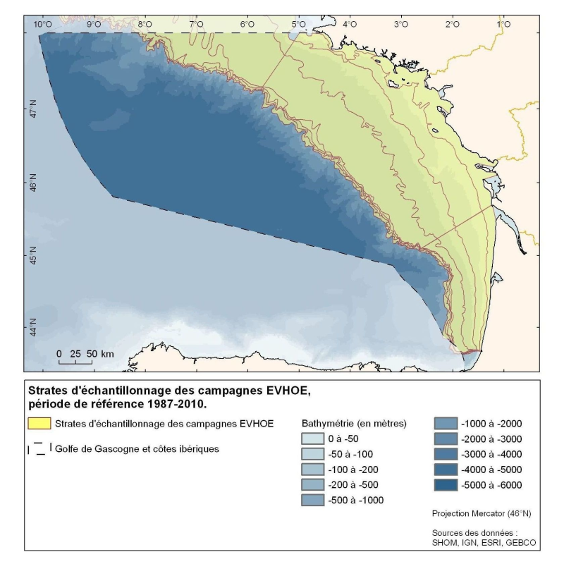
Polygons defined for the distribution of the sampling points of the EVHOE (Evaluation of Fish Stocks in Western Europe) campaigns in the Bay of Biscay and the Celtic Sea.
-
Counting beached marine turtles on the Channel- Atlantic coast, identifying the causes of mortality in dead beached individuals, rehabilitating and releasing live beached individuals into the wild.
-
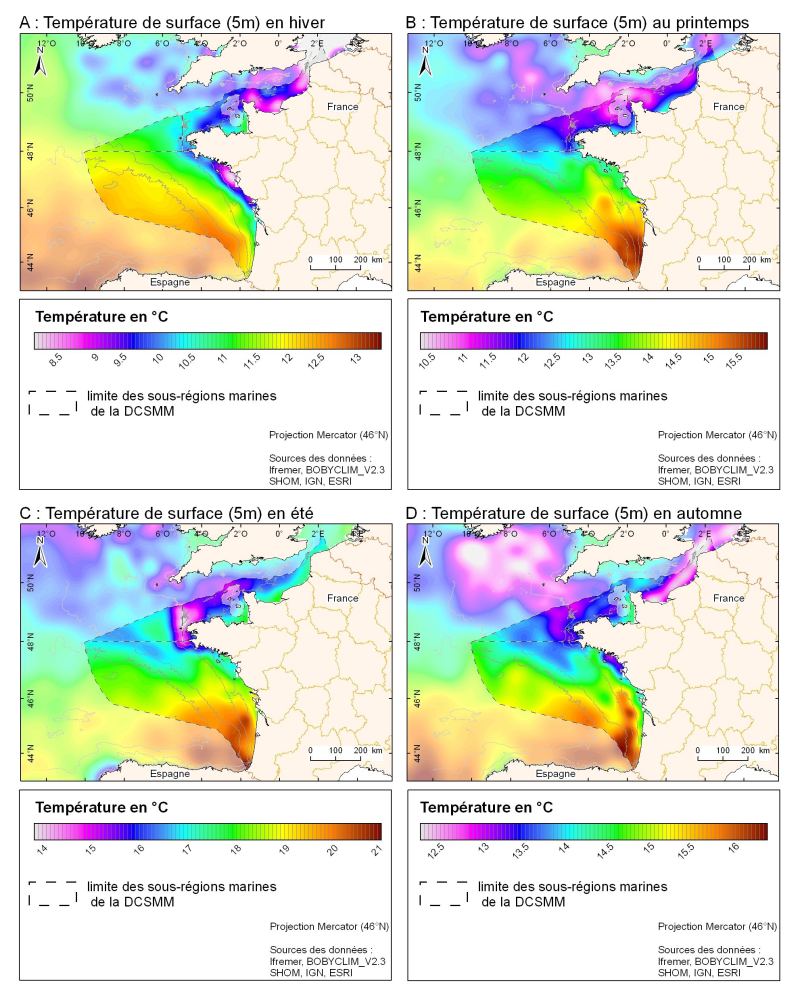
3D seasonal temperature range (in ° C) obtained by objective analysis (interpolation) of the raw data in situ, at a depth of 5m. Within the Bay of Biscay Challenge and the programme of the Operational Coastal Oceanographic Centre Prévimer, the services of SISMER DYNECO-PHYSED of IFREMER have built a joint hydrological database of the Bay of Biscay, from CTD measurements, Bouteilles, XBT / MBT and Profileurs from multiple global data centres to achieve a climatological atlas of the region for temperature and salinity.
-
-
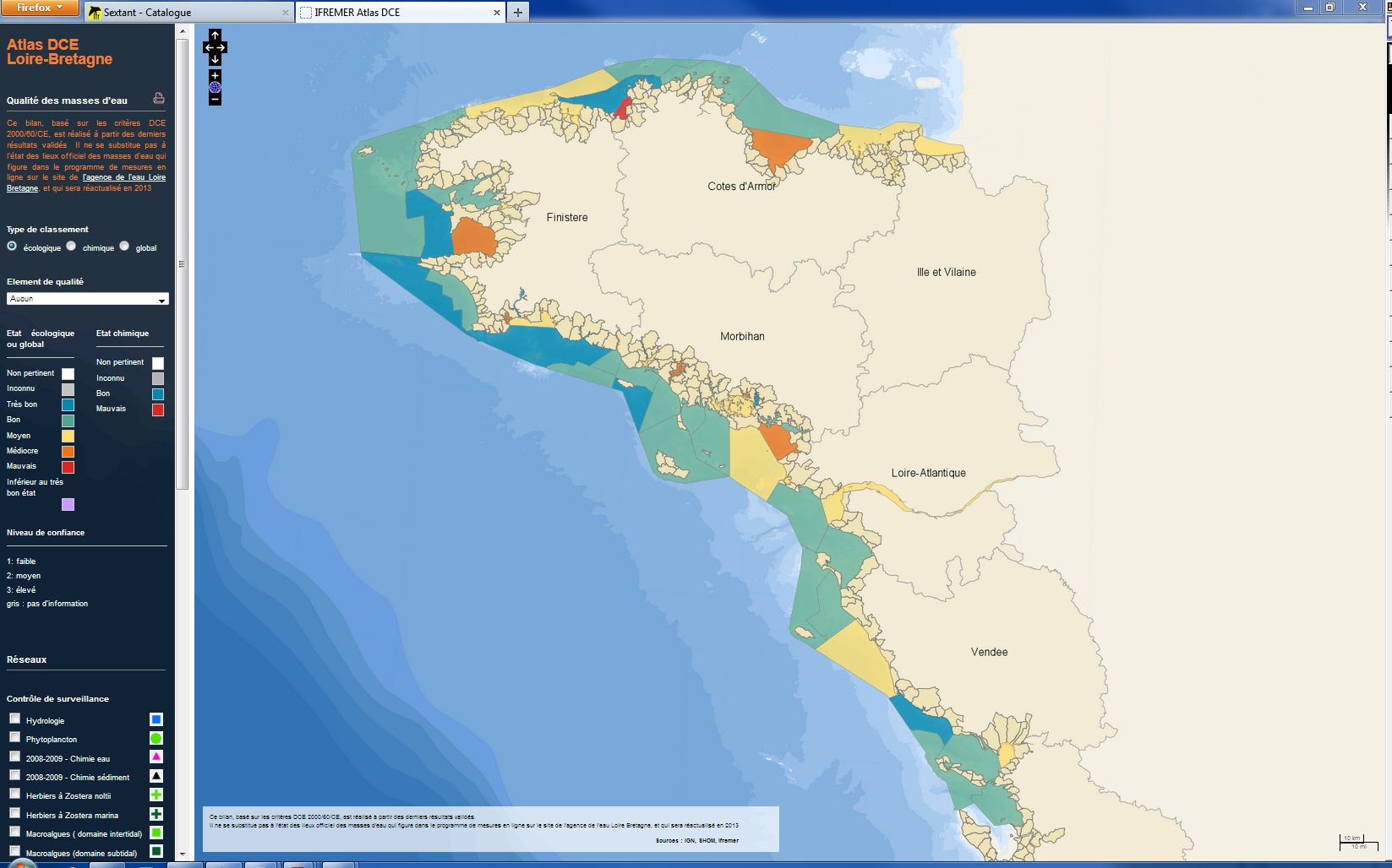
The analysis focuses on monitoring the ecological status of the coastal and transitional waters of the Western Channel and the Bay of Biscay. The ecological status of a coastal water body within the meaning of the European Water Framework Directive (WFD) is determined by the biological state, physicochemical state and hydromorphological state of the water mass, water. The statement is determined according to the rules described in the decree of 25 January 2010.